Province extends comment deadline on caribou habitat plans after pushback from environmental groups
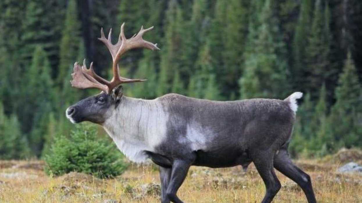
Amid charges that it’s endangering at-risk caribou by putting industry first, the Alberta government has quietly extended the deadline for public comment on three proposed planning documents.
Public engagement now closes Feb. 1 on draft versions of the Caribou Mountains, Red Earth and Berland subregional plans, which direct resource development within much of 11.75 million hectares of land in northern, north-central and west-central Alberta.
Deadlines in late October and early November were already tight for comment when four groups — among them the Alberta Wilderness Association and the Pembina Institute — posted a joint news release earlier this month that criticizes the drafts for disturbing rather than preserving caribou habitat.
The release says that the draft versions rely too heavily on future reclamation and not enough on keeping undisturbed habitat intact in the first place, while failing to publish the data or evidence they rely upon.
“This lack of information limits the public’s ability to provide meaningful feedback on long-lasting land-use decisions that will impact vast regions of the province,” says the release, which was also signed by Nature Alberta and the northern Alberta chapter of the Canadian Parks and Wilderness Society.
The subregional plans will direct industrial and other development on about a quarter of the entire Alberta Crown land inventory, with each plan creating a Go Zone and a Nature First Zone. Neither zone completely bans development.
The office of the Minister of Environment and Protected Areas provided detailed email responses last week to criticisms within the joint release. The office was unable to arrange a Gazette interview with Minister Grant Hunter.
“Listening to feedback from stakeholders, municipalities and Indigenous communities, Alberta’s government has extended the engagement deadline” for the plans, the office said in the emailed statement.
“The extension will provide additional opportunities for targeted engagement and allow more Albertans to share their feedback. This input will help ensure the plans better reflect the perspectives and priorities of the communities and people affected by the proposed changes.”
As of Tuesday evening, the most recent news releases from the provincial government on subregional plans were posted July 24 and Aug. 14. Both highlight earlier and now outdated comment deadlines.
Neither release mentions caribou in its headline, even though protection of their habitat is set out in a now-expired commitment Alberta made with the federal government through the Species at Risk Act.
Under SARA, Alberta was supposed to complete 11 subregional plans by the end of a five-year agreement in October last year. Two were completed in April 2022 and a third just after the expiry date, in November 2025.
The plans were originally envisioned to halt habitat destruction and achieve self-sustaining woodland caribou populations in 12 boreal and three southern mountain ranges.
The federal goal is to reach 65 per cent undisturbed critical habitat in each range. The Alberta percentage is more like 10 to 30 per cent in most ranges, with none meeting the federal benchmark.
The Alberta government estimates that there are at least 2,000 caribou across 15 herds in the province. In the mid-1960s, the total was around 7,000-9,000. By the early 1970s it had dropped to around 3,000.
“Caribou habitat recovery takes time, and we are stepping up more than any Alberta government in recent history,” the minister’s office said in its statement, pointing to $55 million put towards caribou habitat recovery.
That program, which redresses disturbance from legacy seismic lines, has “formed new partnerships with Indigenous communities,” the statement says.
Since 2019 the government has treated and assessed 6,100 kilometres of seismic lines, including more than 3,200 kilometres in the past two years.
Alberta has identified, within caribou ranges, more than 200,000 kilometres of the lines that require assessment and treatment.
“Subregional plans are just one tool Alberta’s government has at its disposal to promote caribou population growth,” says the statement.
“After decades of decline, caribou populations in many of Alberta’s 15 caribou ranges have stabilized or shown growth, particularly in areas where wolf control has been implemented.”
Alberta Environment and Protected Areas conducts what it calls “winter aerial wolf management” — culling from aircraft — across nine of 15 caribou populations on provincially managed lands.
“This targeted approach helps stabilize populations and slow their decline, supporting caribou recovery while critical habitat restoration work continues,” says the minister’s office.
“New land use plans include zones that guide industrial development in sensitive areas while supporting economic growth. The plans set restoration targets for legacy seismic lines and inactive well sites in caribou habitat, backed by new reporting requirements.
“Existing plans and new plans in development will be part of our accelerated progress on restoring land disturbances.”
The ministry pointed out that the government has launched 10-year reviews of two regional plans since 2019.
These reviews are aimed at the larger, overarching plans called the Lower Athabasca Regional Plan and the South Saskatchewan Regional Plan — the only two existing ones of seven envisioned under a provincial land-use framework.
The joint news release criticizing the current drafts says that the subregional plans emphasize doubling oil and gas production and expanding timber harvesting “while missing any opportunity to provide meaningful, long-term protection for caribou habitat. This disconnect highlights an overall lack of concern for caribou.”
The three new drafts do not mention how much of their areas fall within Go and Nature First zones. But a rough eyeballing of maps within each one suggests the Go zones range from about the same size to about six times the size of the Nature First zones.
The Go zones actively permit industrial development like logging, mining, and oil and gas exploration and extraction, while encouraging progressive reclamation. Nature First zones limit new surface tenures and industrial access, and pursue reclamation to hit the 65 per cent target of undisturbed habitat over time.
The earlier Upper Smoky plan, covering an area southwest of Grande Prairie to the B.C. border, gave actual area measures but used slightly different terminology.
Approved in November of last year, it divides the subregion into three zones to reflect allowable uses.
Nature First, the smallest at 3,200 square kilometres, covers parks and protected areas where almost all industrial development remains prohibited. Its areas focus on conservation, habitat restoration, outdoor recreation and traditional land use.
The Slow Go Zone, the largest of the three at more than 5,100 square kilometres, allows some resource extraction and logging within restrictions to reduce footprints and other environmental impacts. Included in Slow Go is a new public land-use zone near Grande Cache for sustainable recreation and tourism.
The Go Zone, at more than 4,900 square kilometres, is identified for a broad range of development but with fewer restrictions on logging and resource extraction than within Slow Go. Recreation and grazing are within the mix, too.
Visit alberta.ca/public-engagement to take part in the survey for the three newest draft plans.
Copyright 2026, The Macleod Gazette. All rights reserved.
George Lee, Local Journalism Initiative Reporter, The Macleod Gazette.