Parts Of Alberta Revealed As Some Of The Worst COVID-19 Hotspots In Canada
Canada recently released a COVID-19 hotspot map that shows parts of Alberta as being some of the worst spots in all of the country.
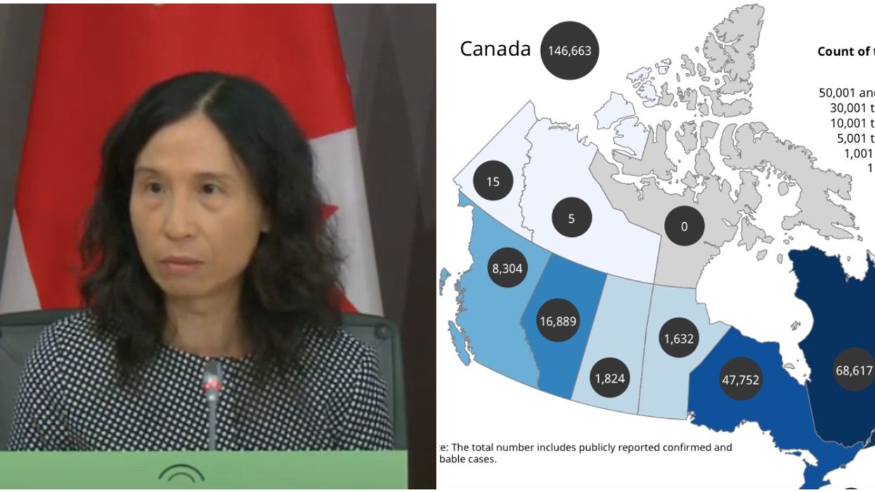
The colour-coded map, which was released by Dr. Theresa Tam and the Government of Canada on Tuesday, September 22, shows different COVID-19 activity across the country. It's based on the incidence rate of the disease per 100,000 people reported over the past 14 days.
Editor's Choice: Edmonton's Active COVID-19 Case Count Is The Highest It's Ever Been
“
Most Canadians don’t have immunity to the virus
Dr. Tam.
In Alberta, the North Zone and the Edmonton Zone are reported to have from 50 to 99 cases of COVID-19 per 100,000 people in the last 14 days.
As of now, Edmonton currently has a record-breaking amount of cases.
Four provinces in total have reported the same numbers including Quebec, B.C., Ontario, and, of course, Alberta.
According to the map and the corresponding data, there have been 146,663 cases with 9,234 deaths and 126,904 recoveries in all of Canada.