Southern Ontario's weather forecast says there's a risk of tornadoes and flash floods
Stay safe out there! 🌪️
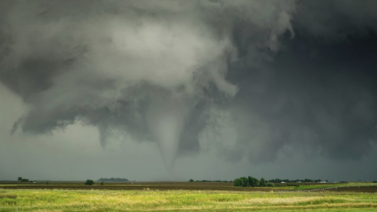
There is a risk of tornadoes in parts of Southern Ontario.
Southern Ontario's weather is turning wild on Wednesday, with a strong storm system that could bring everything from heavy rain and hail to damaging winds and even tornadoes.
The Weather Network (TWN) reports that an active setup is forming as warmer air pushes into the region and there's cold front on the way, creating the perfect storm conditions. The risk zone stretches from southwestern Ontario, in cities such as Windsor and Sarnia, through to the GTA, with two main rounds of storms expected to roll through.
The first round will likely develop in the afternoon, between 2 p.m. and 4 p.m., as a warm front sparks thunderstorms from east of Lake Huron through Kitchener-Waterloo and into Toronto. With a lot of moisture in the air, these storms could pack a punch and bring localized flooding in some areas.
The second round is expected to arrive between 8 p.m. and 10 p.m. as a cold front moves in from the southwest.
TWN says timing will significantly affect the intensity of these storms — an earlier arrival could mean stronger winds, heavy downpours, large hail, and the slight chance of an isolated tornado.
There's a heightened tornado risk in parts of southwestern Ontario, so if warnings are issued, it's essential to have a safe place to go. TWN says the best place is a basement or a windowless room on the lowest floor.
If you are caught driving near a tornado, TWN advises that you don't try to out-run it and don't take shelter under an overpass or bridge, a culvert, or under your own vehicle.
Take lightning seriously, even indoors, during storms like these. Stay away from windows, unplug electronics, skip the landline, and avoid running water during the storm's height.
Flash flooding is another risk to consider. If the rain starts falling fast, don't try to drive through flooded roads — it doesn't take much water to sweep a vehicle away.
If there is a flash flood in your area, TWN says you shouldn't walk or drive through moving water, and you should move to higher ground, stay away from creeks and rivers, and be more cautious at night.
Watch out for weather alerts from TWN and Environment Canada throughout the day and be ready to act if things escalate.
Stay safe out there, Ontarians.
This article's cover image was used for illustrative purposes only.
AI tools may have been used to support the creation or distribution of this content; however, it has been carefully edited and fact-checked by a member of Narcity's Editorial team. For more information on our use of AI, please visit our Editorial Standards page.