There Are 260 Wildfires Raging Around BC & This Map Will Show You Exactly Where They Are
Over 35,000 homes are under evacuation orders or alerts right now.
On Tuesday, August 10 at 7 p.m., the Government of B.C. released an update on the wildfire situation across the province.
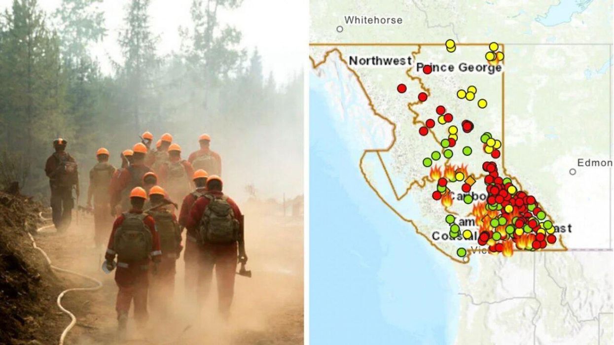
The report said that the situation is quickly evolving and that there are presently at least 260 wildfires blazing in British Columbia. The fires are categorized by fire centre, and the most active fires are located in the Kamloops area where there are 80.
The southeast region of B.C. has 63 active fires, the Prince George area has 57, the Cariboo area has 33, and the rest are split up among the Coastal and northwest fire centres.
The situation is rapidly evolving and changing, so it's important to stay up to date with the most recent status reports. BC Wildfire Service has shared a dashboard with a map so you can locate the active fires across the province.
There are currently around 60 evacuation orders in place affecting approximately 5,392 properties and around 105 evacuation alerts in place affecting approximately 30,899 properties.
The Government of B.C. advises everyone to stay up to date with the latest info on their emergency alerts Twitter account.
- BC Issues Wildfire Travel Warning To These Places - Narcity ›
- Terrifying Photos Of The Wildfires Across British Columbia - Narcity ›
- A Woman In BC Is Canada's First Patient To Be Diagnosed As Suffering From 'Climate Change' - Narcity ›
- A BC Woman Was Diagnosed With Suffering From 'Climate Change' & It Could Be A World First - Narcity ›