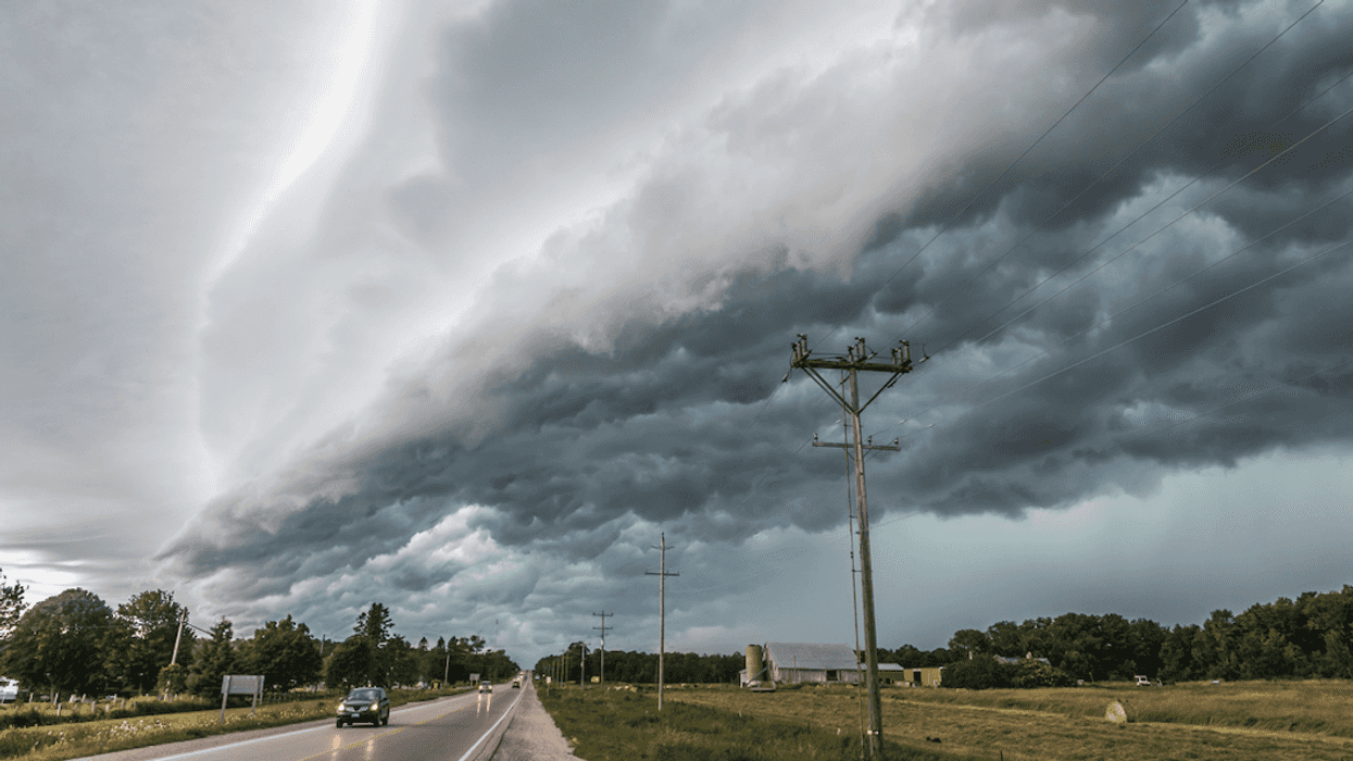
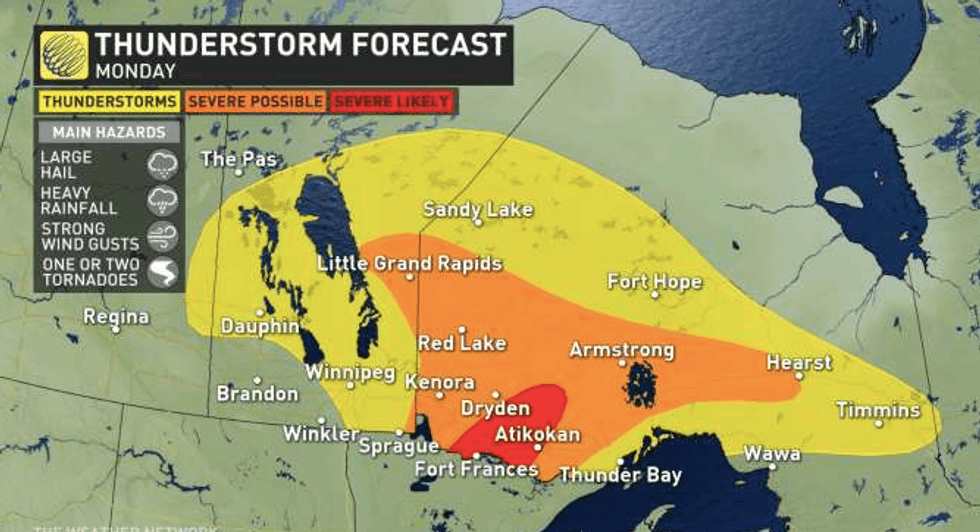
It's going to be a wild Monday evening in northwestern Ontario. According to the Weather Network, severe thunderstorms are forecasted to sweep through the province throughout the day. Ontario's weather forecast will even bring hail and possible tornadoes, so you might want to consider staying indoors.
According to The Weather Network, the most severe hits will take place just west of Thunder Bay.
The areas near Atikokan and Fort Frances are the most likely areas to receive the brunt of the bad weather.
Large hail, strong winds, and heavy rain will all convene in the northwestern parts of the province.
Supercells, which are strong and persistent rotating updrafts, have also been predicted which can even bring a tornado or two during these storms.
TWN is warning Ontarians to take cover if they see any swirling or flying debris, along with roaring sounds coming from the sky.
The best place to seek shelter is in a room on the lowest floor, ideally a basement.
Stairwells, closets, and bathrooms are also some of the safest places in your home to take cover from a tornado, according to TWN.
Not only will it be a stormy day, but Environment Canada has also issued a heat alert for the area, before a significant cool off into the evening.
"Temperatures will reach 30 degrees Celsius today, before falling to 18 degrees Celsius tonight," Environment Canada predicts.
However, this isn't the only storm that the province will be facing this week.
Wednesday is also expected to bring some hefty weather, with wind gusts as strong as 90 kilometres an hour over northeastern Ontario and up to 100 kilometres an hour by Lake Michigan and Lake Superior.
Rainfall could also reach up to 80 millimetres in some areas.
Temperatures are also forecasted to drop into the weekend, so you might want to postpone those beach plans.
According to TWN, provincial temperatures are expected to be 5 to 10 C below the normal seasonal weather.