Southern Ontario's weather could get wild with possible tornadoes & ping-pong ball-sized hail
Southern Ontario may feel more like Oklahoma.🌪️
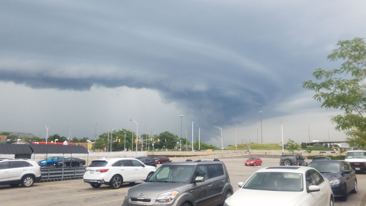
A photograph of a tornado taken in Etobicoke, Toronto, Ontario, in 2020.
It's not your imagination — it does feel like summer out there in Ontario as of Tuesday afternoon.
However, southern Ontario's weather is about to get REALLY spicy, and things are heating up — literally and figuratively. In fact, "all hazards are on the table."
According to The Weather Network (TWN), temperatures are pushing into the high 20s as of Tuesday, and parts of southwestern Ontario are even flirting with the 30 C mark. With the humidity kicking in, it feels more like July than late April, and that sticky air is fueling some serious thunderstorm potential.
TWN says that, "All hazards on the table--including a supercell and tornado risk––as atmospheric conditions will be conducive."
Storms are already starting to pop up across the region, and conditions are ripe for things to get intense fast. If you're anywhere from Windsor through the GTA and into eastern Ontario, you'll want to stay alert for rapidly changing weather this afternoon and evening.
There's a risk of severe thunderstorms, with damaging wind gusts (we're talking 100+ km/h) and heavy downpours. There's even a low risk of an isolated tornado or two. TWN also reports that there may be hail the size of "ping-pong balls".
It's all thanks to a warm, unstable air mass clashing with a cold front sweeping in from the west.
The main window for severe storms is between 3 p.m. and 8 p.m., so don't be surprised if things escalate quickly.
These storms move fast — around 60 km/h — which helps limit flooding risks, but it also means you might not get a lot of warning.
Ontarians in impacted areas are encouraged to monitor the forecast on Tuesday and stay aware of potential watches and warnings. "Conditions can change rapidly as strong storms bubble up," TWN warns.
A cool-down is coming on Wednesday, and early May is already shaping up to be chillier than normal.
Another spell of rain could hit by Thursday night before a more spring-like pattern takes hold next week.
For now, stay safe, stay indoors, and make sure your phone is charged as it's going to be a wild weather ride!
AI tools may have been used to support the creation or distribution of this content; however, it has been carefully edited and fact-checked by a member of Narcity's Editorial team. For more information on our use of AI, please visit our Editorial Standards page.