
It’s time to grab your rain boots and umbrellas, Torontonians. Or, to be honest, you might just want to stay inside. Warnings on Monday morning suggest a severe Toronto storm is on the way on July 27 with super strong winds and Environment Canada is warning of potential damage to buildings and vehicles.
Starting mid-afternoon and continuing into the evening, Toronto is expecting to be hit by winds as strong and fast as 90 km/h, as well as scattered showers and the potential for severe thunderstorms.
Editor's Choice: U Of T Has Released Its Safety Plan For Fall & It Includes Plastic-Wrapped Desks
This will not only affect Toronto but also other areas of Southern Ontario, particularly around the horseshoe towards Hamilton, where the storms are likely to be more threatening.
Environment Canada warns that the type of thunderstorms that could be seen on Monday can “damage buildings, down trees and blow large vehicles off the road."
So, Monday evening sounds like the perfect evening to stay inside, if you ask us.
In addition, The Weather Network has asked Torontonians to be mindful of the risk of yet more flooding — you don’t want to get caught knee-deep in street water.
These warnings are in partnership with the existing heat and humidity warnings for the GTA that have been in force since last week.
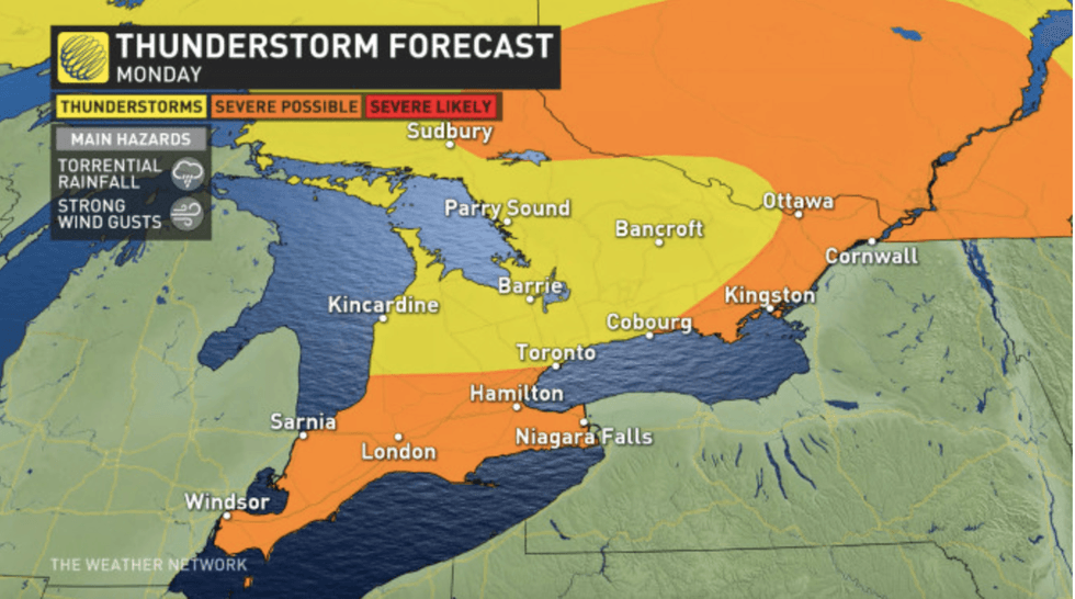 The Weather Network
We are currently expected to hit daytime highs in the 30s or 40s, with the storm hitting late afternoon. Toronto just can’t catch a break weatherwise!
Forecasters say Tuesday may carry some lingering risk for storms, especially for those slightly north of Toronto, but Monday will see the worst of it.
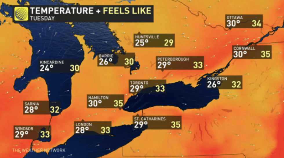 The Weather Network
A potential upside? The cool front that will cause tonight’s thunderstorm holds a chance of cooling things down for us for the rest of the week, “sweeping away humidity and leaving cooler temperatures,” according to TWN.
Remember, though, that "cool" is relative. Temperatures will still be hovering in the mid to high 20s for the remainder of the week.
It's fair to say that Toronto has been no stranger to extreme weather this summer. So far, July has broken all records for being the hottest month in recent history in Ontario.
We’ve also seen our fair share of thunderstorms, causing flash flooding and high winds, and it looks like Monday's going to see at least some kind of repeat of those conditions.
So, if you’ve got errands to run or items to check off your to-do list today, it's recommended that you get them done as soon as possible and make a swift return to the safe and dry indoors.