
Bust out your umbrella. It’s about to get wet and soggy this Friday. Ontario's weather forecast is calling for heavy rainfall across the province. The weather event is forecasted to hit some areas particularly hard, with 75 millimetres of rain and potential flash flooding expected.
According to The Weather Network, leftovers from Hurricane Laura are expected to arrive in Ontario today.
The remnants of the storm, which caused catastrophic damage in Louisiana on Thursday, will bring heavy downpours to the province.
Editor's Choice: Morgan Rielly & Tessa Virtue's New Dog Is Too Cute To Handle (PHOTOS)
Ontarians may also notice a dip in temperature on Friday as the province enjoys a much-needed cool off.
Thankfully, it won’t be too chilly out, as temperatures will still float in the lower 20s, which is around the seasonal norm.
Environment Canada has issued several rainfall warnings for southern Ontario.
The alerts warn of the rain’s potential to cause localized and flash flooding, particularly in low-lying areas.
“Several rounds of showers and thunderstorms will continue to develop across the region. Breaks in the precipitation are expected in the middle of the day, and then more heavy showers and thunderstorms could develop this afternoon or this evening,” reads a statement by Environment Canada.
Some parts of the province are already seeing these heavy downpours, with Windsor airport reporting 47 millimetres of rain early on Friday morning.
Total rain is expected to amount to 75 millimetres in that area and could cause flash flooding and water pooling on streets.
 The Weather Network
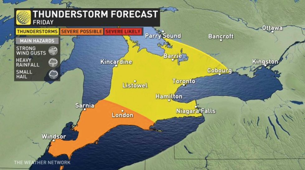
Severe thunderstorms are possible for parts of Ontario today as well.
Residents should keep an eye out for strong gusts of wind and even small hail throughout the day.
Anyone looking to take advantage of the last days of summer will be able to do so next week, as a brief return to heat and humidity is expected.