Parts Of Ontario Are About To Be Hit By 'Ping Pong-Sized Hail' & Tornadoes Are Possible
Toronto is under a severe thunderstorm watch.
If you've ever wondered why a red sun is a bad omen, Ontario's weather forecast today is prepared to spell it out for you.
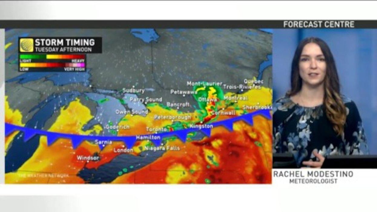
Parts of the province will be hit by a barrage of nasty weather Tuesday afternoon with conditions expected to bring massive hail, gusty winds, and dangerous thunderstorms to the east.
Environment Canada has issued a severe thunderstorm watch for Toronto, Ottawa, Peterborough, Halton and other regions.
According to Environment Canada, some of the notable hazards will include "ping pong-sized hail," 110 km/h wind gusts, and even potential tornadoes.
"Large hail can damage property and cause injury. Very strong wind gusts can damage buildings, down trees and blow large vehicles off the road," an excerpt from the weather alert reads.
High levels of air pollution will also plague residents in southern Ontario due to smoke funnelling in from active forest fires.
Residents are being asked to continue to watch for weather updates and reduce exposure when possible.
- Ontario's Weather Forecast Is Going Get Snowy AF This Week ... ›
- Ontario's Weather Forecast Includes Flash Flooding & It's Because ... ›
- Ontario's Weather Forecast Is Calling For Heavy Rain & Tornadoes ... ›
- A Tornado Threat Is In Place For Southern Ontario Today With Large Hail & Heavy Rainfall - Narcity ›
- Environment Canada Warns Of Flash Flooding As Ontario Becomes A Sopping Mess This Week - Narcity ›
- Ontario's Weather Forecast Is Going To Be A Cold & Soggy Mess This Week - Narcity ›
- Ontario's Weather This Thanksgiving Weekend Will Be Hotter Than Mexico In Some Spots - Narcity ›
- Ontario's Weather Forecast Will Be Full Of Summer Heat & Thunderstorms This Week - Narcity ›
- Ontario Winter Weather Forecast Was Just Revealed & It's Going To Be Surprisingly Warm - Narcity ›
- Ontario's Weather Forecast Says A Snow Squall Is Coming & Road Closures Are Possible - Narcity ›