Multiple Tornadoes & Massive Flooding Wreaked Havoc In Ontario This Weekend (VIDEOS)
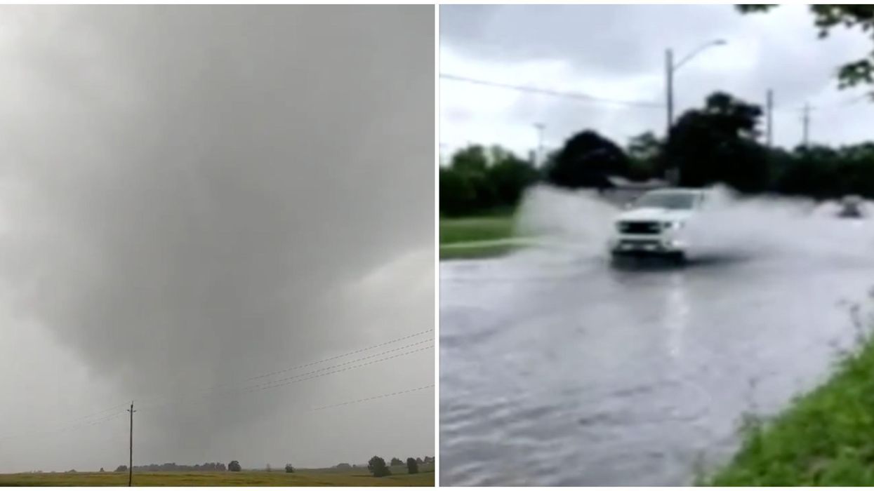
It was a wild weekend across parts of Ontario after intense rainstorms hit. Environment Canada has now confirmed that three tornadoes touched down on Sunday, and made one last appearance again on Monday. The tornadoes in Ontario were travelling at speeds of up to 150 kilometres an hour and flooding was also reported.
According to an Environment Canada weather summary, the twisters were confirmed in the areas of Camden East, Oxford Mills, and Kinmount, Ontario.
Editor's Choice: Canada's COVID Alert App Has Been Downloaded Over A Million Times In Just 3 Days
The first three all happened on Sunday afternoon, initially hitting Camden East at around 2:35 p.m.
Not far behind, another one was spotted in Oxford Mills at 4:25 p.m. and then in Kinmount at 4:50 p.m.
The winds were going faster than 90 kilometres an hour, and in some areas, significantly faster.
Photos of snapped trees, flying debris, and other chaotic damage were shared on social media.
Kinmount was the area hit the hardest, with winds thrashing at 150 km/h causing their tornado to receive an EF1 rating.
The other two got EF0 ratings, with only light to moderate damage.
Monday brought about one last funnel that caused tree wreckage in the area of Mitchell, Ontario.
Although the information is still considered preliminary while weather analysts study the area, there are lots of first-hand accounts of the storms that were caught on video.
Security video footage from Camden East shows building winds that suddenly begin to hurl debris into the air.
Footage of a funnel cloud was also captured in Kitchener-Waterloo, although it was not mentioned in Environment Canada's weather summary.
Not only were the winds high, but the wreckage was significant.
Photos of massive trees laying on the floor snapped in half shows just how powerfully the winds were blowing. Toronto wasn't spared from the same problem.
Snapped trees and water buildup were issues in the 6ix over the weekend.
Toronto Police even warned of high water levels on the Gardiner Expressway on Sunday, and flash flooding was also recorded.
The Toronto Region and Conservation Authority (TRCA) issued a water safety statement which will be in effect until Wednesday.
Toronto received an average of 20 millimetres of rain on Monday, with some areas even recording 35 millimetres, TRCA reports.
Tornado and thunderstorm watches have been a trend this summer. Ottawa and other parts of Ontario have also had their fair share of tornado warnings recently.