Please complete your profile to unlock commenting and other important features.

Please select your date of birth for special perks on your birthday. Your username will be your unique profile link and will be publicly used in comments.
Narcity Pro

This is a Pro feature.

Time to level up your local game with Narcity Pro.

Pro

$5/month

$40/year

  • Everything in the Free plan
  • Ad-free reading and browsing
  • Unlimited access to all content including AI summaries
  • Directly support our local and national reporting and become a Patron
  • Cancel anytime.
For Pro members only Pro
Summary

Toronto's weather forecast says more snow is on the way and the GTA could get up to 10 cm

Southern Ontario will be snowy on Tuesday and Wednesday! ❄️

people walking across a toronto street in front of cars as it snows

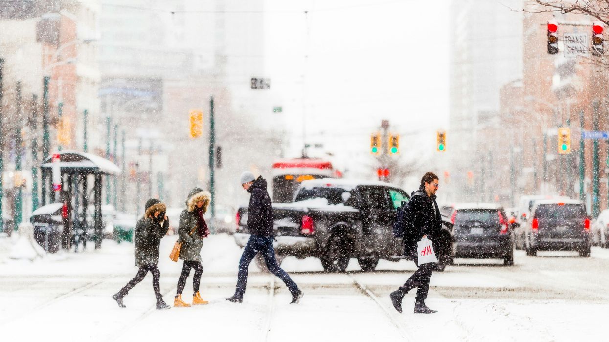
People crossing a Toronto street during a snowstorm.

Senior Writer

This new forecast has revealed that Toronto's weather is getting snowier.

It's expected that up to 10 cm of snow could fall in Toronto and the GTA over the next few days.

According to The Weather Network, there will be "widespread snow and travel impacts" as a wintry weather system moves into southern Ontario on Tuesday, January 28.

Snow is expected to intensify across the snow belt areas through the afternoon and then reach the GTA by the evening.

The Weather Network said that this snow will be "wetter and sticky" which means there will be quite a bit of accumulation as flakes continue to fall through Tuesday night.

Three to more than five cm of snow is forecast for Toronto, along with areas along the northwestern shores of Lake Ontario like Oakville.

Five to 10 cm of snow is expected in the GTA, including Brampton, Mississauga, Markham, Newmarket, Orangeville, Pickering, and more cities.

This snowstorm will be more potent outside of the GTA, with 10 to 15 cm forecast for Barrie, Collingwood, Orilla and surrounding areas.

Also, 10 to 20 cm is expected in places east of Lake Huron, including Mount Forest and Hanover.

Wind gusts are set to strengthen in southwestern Ontario on Tuesday night, causing blowing snow and whiteout conditions in Kincardine, London and surrounding areas.

Then, lake-effect snow will start as the weather system moves out of southern Ontario on Wednesday, January 29. High snowfall totals and "dangerous whiteout conditions" are likely.

  • Senior Writer

    Lisa Belmonte (she/her) is a Senior Writer with Narcity Media. After graduating with a Bachelor of Journalism from Toronto Metropolitan University (formerly Ryerson University), she joined the Narcity team. Lisa covers news and notices from across the country from a Canada-wide perspective. Her early coverage of the COVID-19 pandemic earned Narcity its first-ever national journalism award nomination.

Parts of Ontario are forecast to get more than 30 cm of snow this week

A major snowstorm in the north and lake-effect snow in the south! ❄️

Canada just made a major change to citizenship rules and more people can now apply

You might already be a Canadian citizen without knowing it! 🇨🇦 👀

Ontario's top baby names have been revealed and one name has dominated for over a decade

The most popular names in Ontario are a bit different than Canada's top names. 👀

TTC jobs for students are available in Toronto and you can make up to $24 an hour

There are jobs in admin, mechanical support, customer service, and other departments.

Canada's favourite grocery stores for 2025 were revealed and these are the top retailers

A grocery store chain in Quebec beat some national retailers, including Walmart. 👀