You Can Track All The Wildfires Raging Through Northern Ontario RN Using This Free New App
It works all over Canada, too.
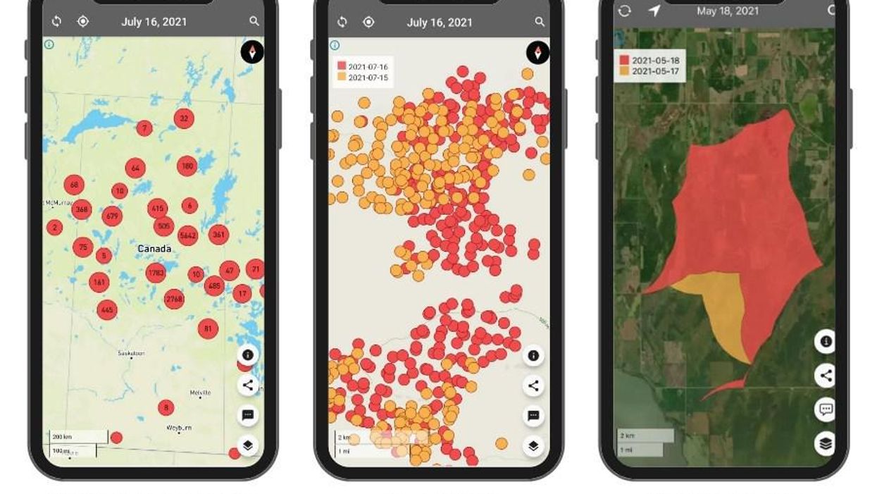
A new app is helping Ontarians detect and monitor hundreds of forest fires in "near real-time."
The software, called FireFringe, uses satellite technology to create detailed maps of forests before pairing it with sensors from NASA to detect high temperatures.
Ontario Forest Fires reported that as of Sunday morning, 117 forest fires were active in Northern Ontario, with a total of 724 fires this season alone. Environment Canada issued air quality statements for areas across the province on Tuesday morning, including major cities like Toronto, Ottawa and Hamilton.
"There are thousands of fires raging right now in Canada, causing devastation," said Phil Green, CEO of First Resource Management Group, the developers behind FireFringe. "Our app can help save communities. It shows where fires are beginning to grow and can help predict where they are headed. It's simple and visual to keep people informed and safe."
The app uses data from Natural Resources Canada to locate the perimeters of fires and pinpoint hot spots, which can help identify what is fuelling the fire, track its progress, and give emergency crews more time to prepare and respond.
You can visit the FireFringe website here.
- Ontario Weather Forecast Calls For Smoky Skies & Thunderstorms ... ›
- Ontario Weather Forecast Is Bringing Possible Tornadoes - Narcity ›
- Toronto Air Quality Is Some Of The Worst In The World RN - Narcity ›
- London Fire Crew Shows Scary Photo Of What Could Happen If You Aren't Careful With Candles - Narcity ›