Severe Storms Are Taking Over Ontario Today With Possible Tornadoes, Damaging Winds & Hail
You might want to stay inside today.
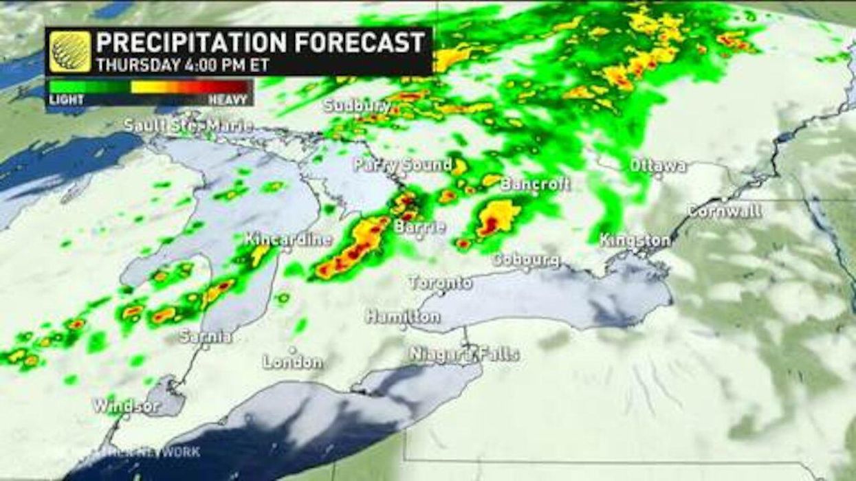
Southern Ontario's weather forecast is about to get blasted with some nasty storms on Thursday, so you might want to cancel your patio plans.
According to The Weather Network, several regions are at risk for severe thunderstorms today due to an incoming cold front pushing into the unstable and warm air that is currently in the region.
The event will create ideal conditions for tornadoes, with damaging winds, large hail and heavy rainfall also expected to wreak havoc on parts of the south.
At the moment, regions located east of Lake Huron and Georgian Bay face the greatest threat, including Barrie, Grand Bend, Kitchener and Orangeville.
However, areas in the GTA still have the possibility to also experience these severe conditions.
On top of this, Thursday is also expected to be extremely hot. "Thursday will also be the warmest day in what has already been a scorcher of a week, with afternoon highs in the upper 20s to around 30°C, with humidity pushing the feels-like into the mid-30s," TWN states.
- Ontario Weather Forecast Is Predicting Possible Tornadoes Today ... ›
- Bug Tornadoes In Ontario Look Like A Horror Movie (VIDEO) - Narcity ›
- Ontario Forest Fires Can Now Be Tracked By A Free New App - Narcity ›
- Environment Canada Warns Of Flash Flooding As Ontario Becomes A Sopping Mess This Week - Narcity ›
- Ontario's Weather Will Be A Mess This Weekend Thanks To Remnants Of Hurricane Pamela - Narcity ›