Severe 'Supercell' Storms Are Heading Into Ontario Today & Tornadoes Are Possible
It's going to feel almost 10 degrees hotter than forecasted.
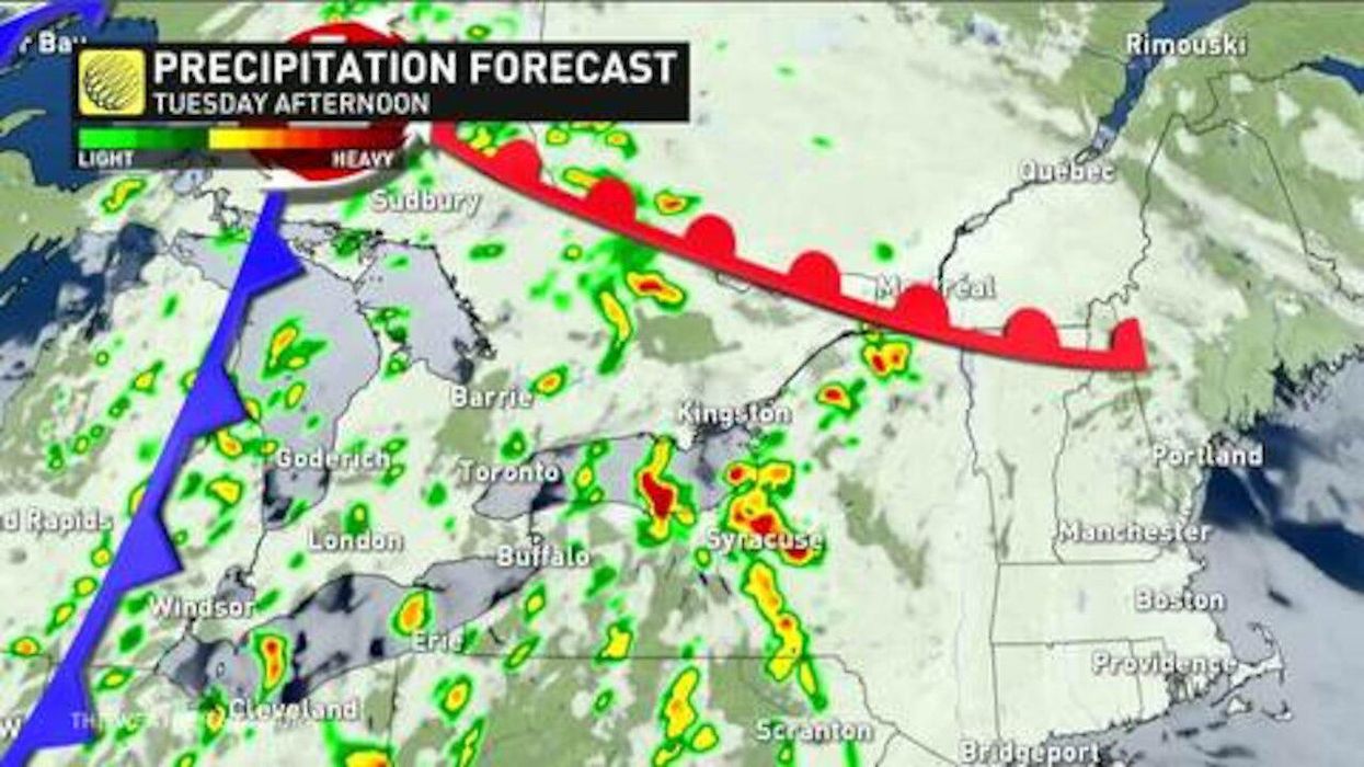
Ontario's weather forecast is predicting a soupy mess today, with hot temperatures and severe storms on the way.
According to The Weather Network (TWN), a wave of unbearable humidity and storm threats will sweep the province with daytime temperatures of over 30 degrees bringing a possibility of tornadoes in some areas.
"There's a fair bit of supercell potential for eastern Ontario as well, such that a tornado can't be completely ruled out, along with the chance of enough locally-heavy rain to trigger some flooding," a report from TWN reads.
The areas most likely to face extreme weather include Parry Sound, Bancroft, and the Ottawa Valley.
However, spots like Toronto, Niagara and Hamilton will still face a risk of severe storms throughout Tuesday, with a risk of strong winds, large hail and torrential rainfall.
This article's cover image was used for illustrative purposes only.
- Tornadoes In Ontario Can Get As Bad As In The U.S. If The ... ›
- Ontario Weather Forecast For July Is Going To Be A Stormy Mess ... ›
- Ontario Weather Forecast Is Brining Possible Tornadoes - Narcity ›
- Severe Thunderstorm In Parry Sound Rips Trees From Their Roots - Narcity ›
- Ontario's Weather Forecast Warns Of Intense Storms This Week - Narcity ›
- Ontario's Fall Forecast Just Dropped & It's Going To Get Extremely Snowy & Cold - Narcity ›
- A Tornado Threat Is In Place For Southern Ontario Today With Large Hail & Heavy Rainfall - Narcity ›