Ontario’s Sticky, Stormy Heat Wave Ends Today & This Weekend Will Be Gorgeous AF
No more extreme heat!
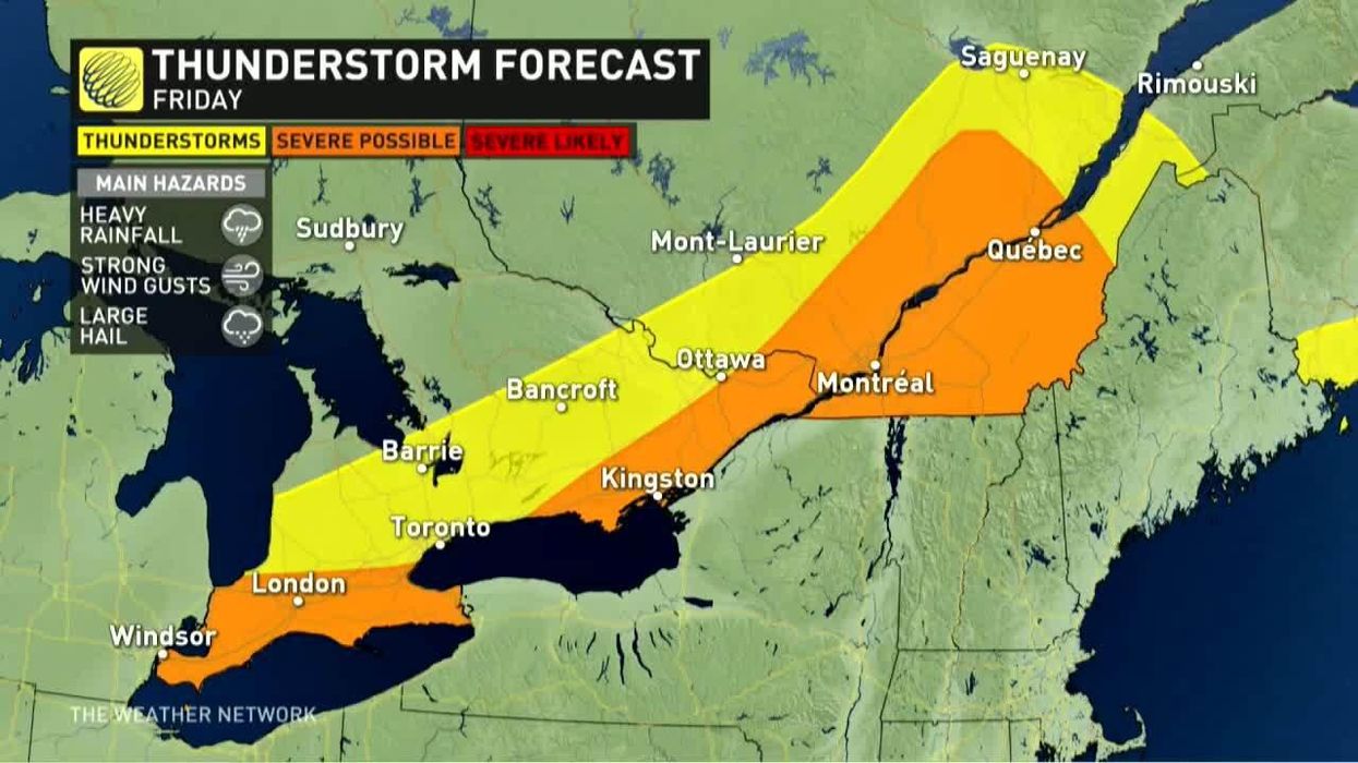
The scorching heat that has dominated Ontario's weather forecast this week is expected to finally come to an end on Friday, but it won't be a peaceful transition.
According to The Weather Network, an approaching cold front is expected to swoop into the province, eliminating the intense levels of heat and humidity while creating a risk for severe thunderstorms.
The stormy conditions won't last long though, as a wave of fresher air, sunshine and seasonal temperatures will bring back summer to Ontario by Saturday.
Toronto and its surrounding areas will see a beautiful 24-degree day full of sunshine on Saturday.
The pleasant vibes will stretch into early next week ahead of a tropical system that could bring enough moisture to cause some trouble by next week.
"If tropical moisture comes far enough north, then we will have an increasing risk for showers and thunderstorms for southern areas," Dr. Doug Gillham, TWN meteorologist, warns.