Parts Of Ontario Will Be Hit By Severe Thunderstorms & Large Hail This Week
And it's still going to be a scorcher.
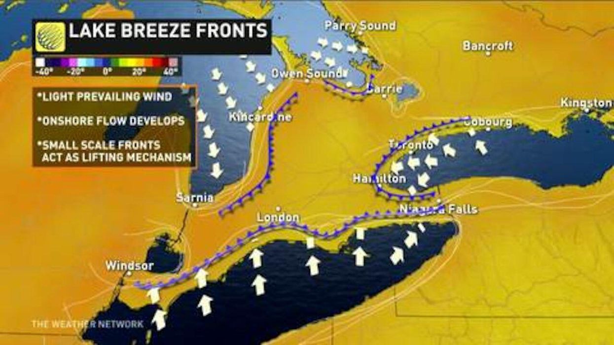
As parts of Ontario continue to suffer the effects of an early June heatwave, others are stuck in the path of stormy conditions.
According to The Weather Network (TWN), northeastern regions such as Sault Ste Marie, Timmins and Chapleau are forecasted to be hit by severe thunderstorms and hail on Monday, with storms continuing throughout the beginning of the week.
"Northern areas will see the greatest risk of a strong or severe storm on Tuesday, as a pressing cold front boosts instability and provides a triggering mechanism, leading to a risk of locally heavy downpours and large hail for parts of cottage country and the Ottawa Valley," Michael Carter, a TWN meteorologist, said.
The incoming weather event will be much less severe in southern regions, but areas like Toronto, London and Windsor could still experience thunderstorms and passing showers.
Meanwhile, Environment Canada issued heat warnings across the province as daytime temperatures continue to rise above 30 C.