Ontario's Weather Forecast Is Predicting A Soggy Mess Today & Driving Will Be Horrible
You may want to reschedule your plans.
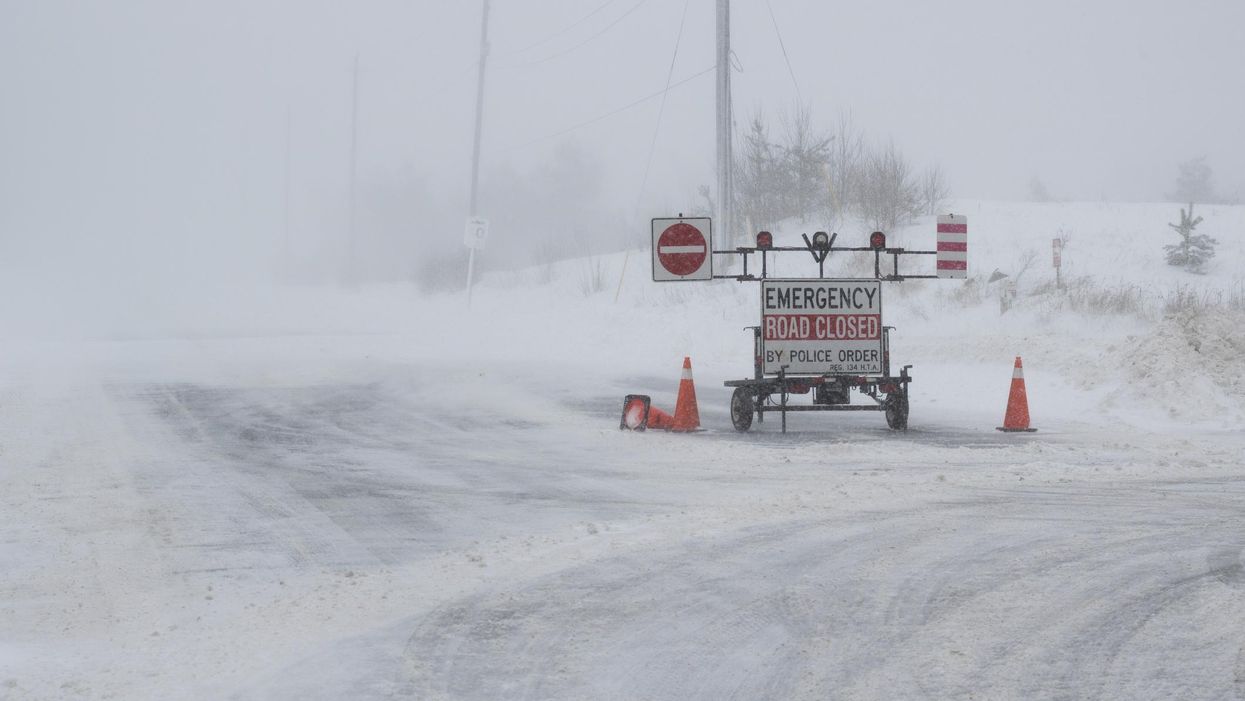
An emergency winter road closed in Ontario.
Would you rather be flooded by downpours or drive in whiteout conditions? That's the dilemma facing Ontarians from both sides of the province on Thursday, as unsettled conditions continue to dominate this week.
On Thursday, Environment Canada issued special weather statements for northern and southern Ontario due to an incoming barrage of torrential rain and snowstorms.
Unlike the switcheroo that happened earlier this week when the south saw a cool down and the north got double-digit highs, things will be pretty much how you'd expect.
Southern cities like Ottawa and its surrounding communities will be the soakers of the province with 20 to 30 millimetres of rain through Thursday and totals possibly reaching 45 millimetres before tapering off Friday morning.
You're going to want to avoid strolling near any creeks or riverbanks as well, as the downpours could lead to some localized flooding.
Northern regions like Moosonee, Kapuskasing, and Timmins will face an onslaught of wintry weather with 20 to 30 centimetres of possible snowfall.
As if that wasn't bad enough, strong wind gusts of up to 70 km/h are also in the mix, which will significantly impact visibility thanks to blowing snow.
"A low pressure system is expected to affect the area beginning this evening and continuing into Saturday. Snow, heavy at times, and blowing snow are expected with this system," Environment Canada warns.
"Rapidly accumulating snow could make travel difficult over some locations. Prepare for quickly changing and deteriorating travel conditions. Visibility will be suddenly reduced to near zero at times in heavy snow and blowing snow," it adds.
Anyone planning to travel on Thursday should exercise caution and stay updated with their local weather forecast.