Ontario's Weather Forecast Predicts Up To 30 cm Of Slush This Week Due To A 'Snow Machine'
It's going to be a rough few days. 🥶👇
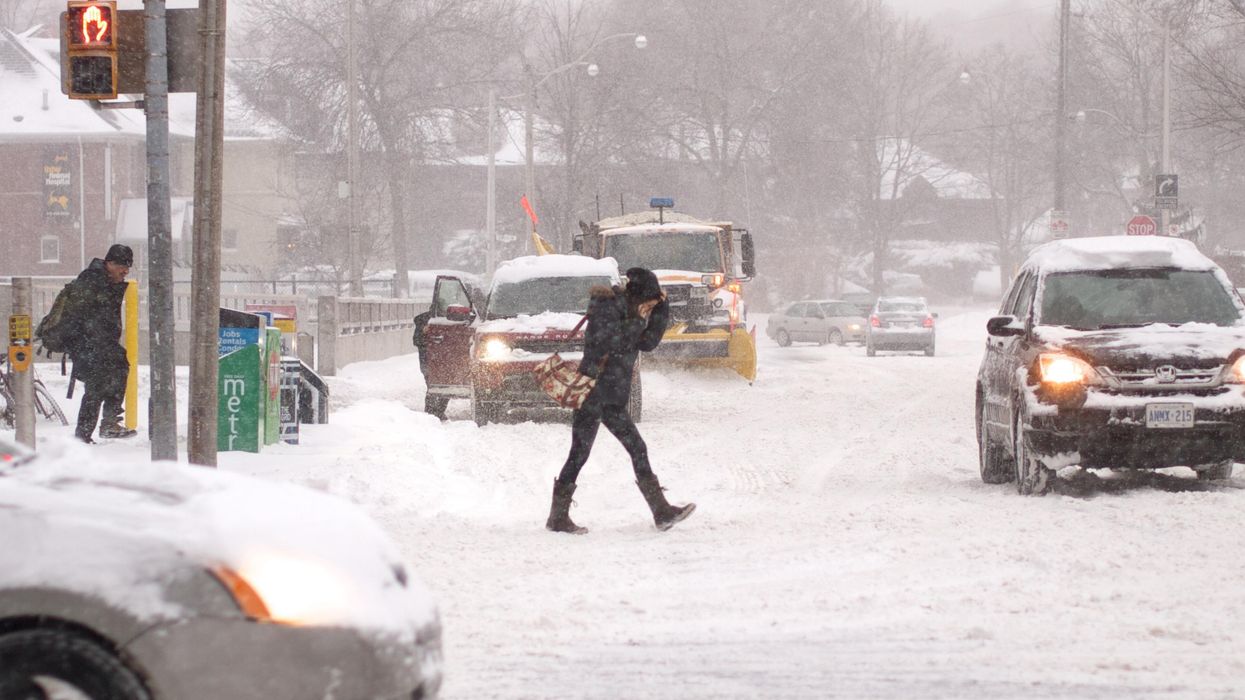
Break out your winter boots, because Ontario's weather forecast is predicting quite a bit of snow, and it's going to make road visibility pretty bad.
"Parts of Ontario's snowbelt regions will see potent lake-effect snow squalls kick-start the new work week, likely disrupting travel and bringing accumulations of 15-30 cm by the time they ease off Tuesday," says The Weather Network.
Starting on Sunday, November 21, southern and central Ontario will see a bit of rain, but overall less than 5 millimetres of precipitation is expected.
Monday and Tuesday are when things start to get hectic, though.
"A winter weather travel advisory and special weather statements are in place for parts of cottage country and southern Ontario, respectively, ahead of the impending development of lake-effect snow squalls," says TWN.
To make things even more chaotic, there will be wind gusts of around 60 km/h. The worst of the weather will hit southern Ontario starting Monday morning and into the afternoon.
"Concern is there for a snow band to develop and intensify as there is the chance that winds align out of the northwest over both Lake Superior and Lake Huron, allowing for an intense squall to form and move inland, impacting the snowbelts," TWN meteorologist Jessie Uppal explained.
As for Tuesday, there's the possibility for snow squalls in the morning, but they'll be "less intense" than Monday's patterns and will eventually turn into flurries by the afternoon.
Environment Canada warns that travelling during this time can be dangerous and advises motorists to be careful on the roads and be mindful of deteriorating visibility.
By Wednesday, the weather will return to seasonal temperatures, but "more unsettled weather" is possible for later in the week. Yikes!
This article's cover image was used for illustrative purposes only.
- Christmas Weather Forecast In Canada Is 'Very Unsettled' - Narcity ›
- Ontario's Christmas Forecast Is Going To Be 'Brutally Cold' - Narcity ›
- Ontario's Weather Forecast Is Calling For A Snowy, Rainy Mess & Up To 20 cm In Some Areas - Narcity ›
- Ontario's Weather Is So Windy Today That Several Power Outage Warnings Have Been Issued - Narcity ›
- Ontario’s Weather Forecast Calls For A Windy, Rainy Mess & ‘Damage To Buildings May Occur’ - Narcity ›
- Ontario's Weather Forecast Warns Of Some Spots Being Hit With Freezing Rain This Week - Narcity ›
- Ontario's Weather Calls For Up To 20 cm Of Snow This Week & You'll Want To Just Stay Home - Narcity ›
- Ontario’s Weather Will Hit Some Spots With So Much Snow This Week & It’ll Be Messy - Narcity ›
- Ontario's Weather Will Be Bone-Chilling With 'Freezing Rain' Coming This Weekend - Narcity ›
- Ontario Weather Is Predicting Toasty Warm Temps Next Week & Bust Out Your Sunglasses - Narcity ›
- Ontario's Weather Forecast Predicting Warmest St. Patrick Day In 10 Years For Some Parts - Narcity ›
- Toronto's Weather Will Be Full Of 'Sneaky Snow' Today & It's Going Mess Up Your Commute - Narcity ›
- Ontario's Weather Forecast Says A 'Snow Machine' Is Coming & It's Gonna Feel Like February - Narcity ›
- Parts Of Ontario Will Be Sunny & Warm This Week But Toronto's Not One Of Them - Narcity ›
- Ontario's Weather Forecast Is Predicting 30 cm Of Snow Today & It's Going To Be A Mess - Narcity ›
- Ontario's Weather Forecast Is Predicting A Soggy Mess Today & Driving Will Be Horrible - Narcity ›
- Ontario's Weather Forecast Predicts 40 cm Of Snow This Week & It Could Get Dangerous - Narcity ›
- Toronto's Weather Forecast Calls For Summer-Like Vibes This Week But It Won't Last Long - Narcity ›
- Ontario's Weather Forecast Predicts Up To 10 cm Of Snow Today & Driving Will Be Messy AF - Narcity ›