Ontario’s Weather Forecast Calls For A Windy, Rainy Mess & 'Damage To Buildings May Occur'
Environment Canada has issued special weather statements for so many areas. ❄️🌧
Southern Ontario is in for a wild day of weather with strong winds, freezing rain, and possible snow squalls across the province.
As of Monday morning, Environment Canada has issued 22 special weather statements for heavy rain and strong winds across southern Ontario.
A special weather statement was issued for Toronto at 4:29 a.m., warning residents of "strong winds with gusts of 70 to 80 km/h."
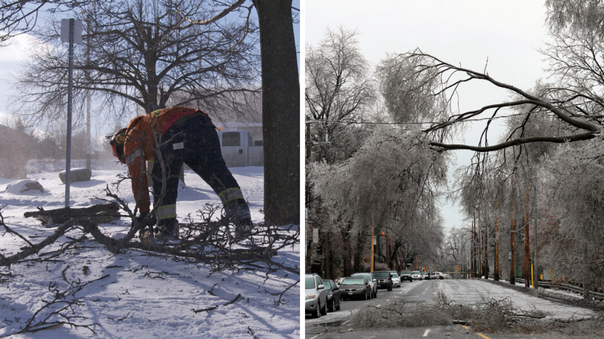
According to Environment Canda, the wind gusts ripping through the city "can toss loose objects, damage weak buildings, [and] break branches off trees."
The windy weather is expected to show up this afternoon due to a passing cold front, and areas between Kingston and Prince Edward County could get winds up to 90 km/h.
Strong winds & freezing rain
Wind warnings are in place for Barrie, Orillia, Midland, Grey-Bruce, Huron, Perth, Kingston, Prince Edward, and the Parry Sound to Muskoka area.
Wind gusts up to 90 km/h are expected to arrive in the afternoon and stay throughout the night and could damage buildings, roofs, and windows.
In some areas, freezing rain will be coming down with warnings in place for Ottawa, Prescott, Russell, Renfrew, Pembroke, Barry's Bay, Smiths Falls, Lanark and Sharbot Lake.
Environment Canda warns "highways, roads, walkways and parking lots may become icy and slippery" and that "weather conditions may contribute to transportation delays."
The freezing rain is expected to fall this morning to "midday" and eventually turn into rain however, build-ups of ice may even "cause tree branches to break."
Snow squall watch
Snow squall watches are also in place for multiple areas across southern Ontario, including Barrie, Orillia, Midland, Dufferin, Innisfil, Grey-Bruce, Huron, Perth, Peterborough, Kawartha Lakes, York and Durham.
Environment Canada says the conditions for "lake effect snow squalls off Georgian Bay" are "favourable" for tonight, with a possibility of over 15 centimetres of snow coming down in 12 hours.
The heavy snowfall is expected to start early this evening and continue tomorrow.
Environment Canada warns that the snow could cause reduced visibility for drivers and that "highways, roads, walkways and parking lots may become difficult to navigate due to accumulating snow."