Ontario's Weather Resulted In A Tornado Warning Yesterday & More Storms Are On Their Way
Heavy rain and hail are possible.
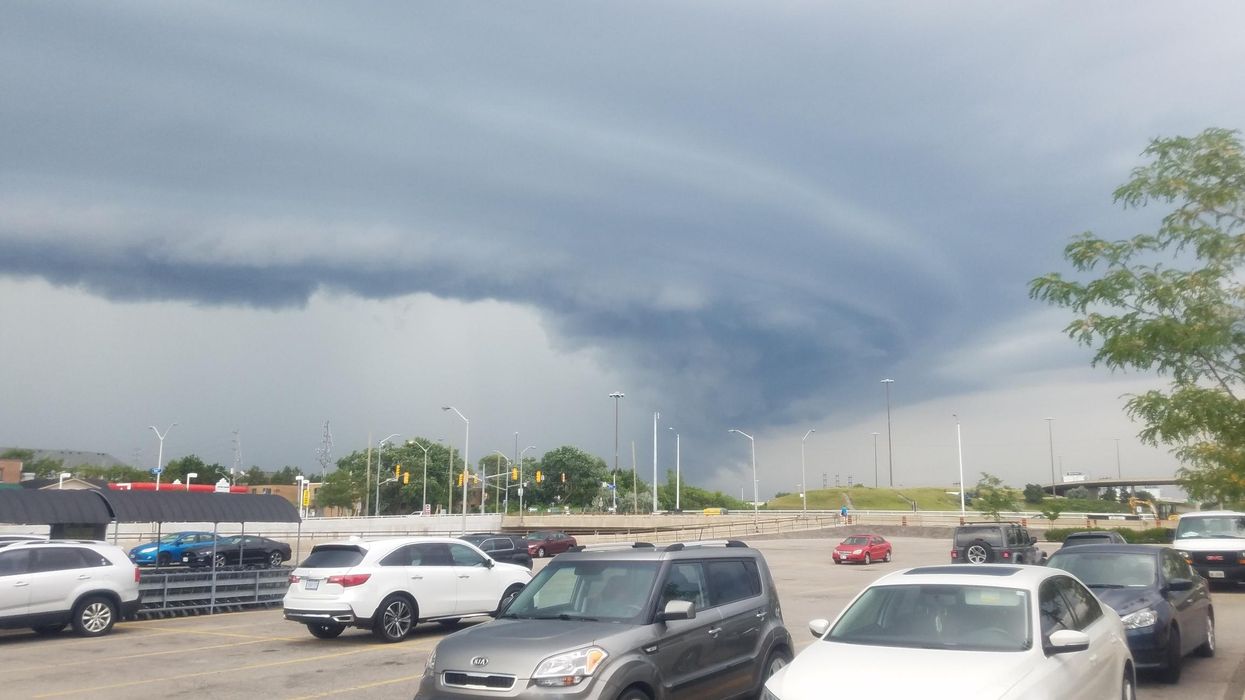
A tornado forming in Ontario.
Ontario's weather got off to a turbulent start this week after Monday's forecast brought tornado warnings and 100 km/h winds to several regions.
According to The Weather Network (TWN), residents will be in for more of the same on Tuesday, with a severe storm threat already looming over eastern parts of the province.
The nasty weather results from an "amplified jet stream pattern" set to drop temperatures in Ontario by midweek.
"The same system helping to usher in the cooler air is also sparking a widespread thunderstorm risk across the region through Tuesday," TWN reports.
Regions such as Windsor and Sarnia were nearly blown away by the powerful winds that swept across the province on Monday evening.
Residents flooded Twitter with photos of downed trees, hydro poles, and clouds that looked straight out of an episode of Stranger Things.
Niagara will be at the most significant risk for severe weather on Tuesday, with torrential rains, strong wing gusts, and large hail all expected to creep into the region's forecast.
Anyone who's been glued to their A.C. unit since the weekend can take comfort in knowing that the storms will bring about a much-needed pattern of chillier weather.
"By Thursday, an anomalously chilly lobe of air presses south across northern Ontario, dipping temperatures upwards of 10°C below seasonal for early September near the Ontario and Quebec border," it adds.
The early taste of fall temperatures won't last long, though, as that old sticky combo called "heat and humidity" will return over Labour Day weekend, so enjoy the sweater weather while you can.