Powerful Winds Are Set To Slam BC Today In What Could Be A 'Potentially Historic Storm'
There's going to be lots of rain too!
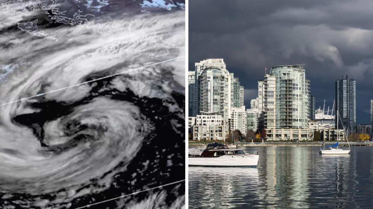
Those living in certain parts of B.C. might want to brace themselves this weekend as some powerful winds are about to hit the province - here is an hour-by-hour forecast of the high-risk areas.
According to The Weather Network (TWN), the province has been gearing up for what is expected to be a "potentially historic storm" on Sunday, October 24.
The Pacific storm has and has already met the criteria for what forecasters called a "weather bomb," which according to TWN is "when the pressure drops 24 millibars (mb) in 24 hours -- in nearly 12 hours."
As a result, Environment Canada has issued a special weather statement for several areas including Metro Vancouver, Southern Gulf Islands, and parts of Vancouver Island.
According to the agency, "very windy conditions are forecast to develop through today for Vancouver Island and neighbouring regions along the Strait of Georgia. The strong winds will persist until Monday evening."
Southeast winds anywhere from 70 to 90 km/h are expected to hit the area, with some gusts having the potential to exceed 100 km/h.
Environment Canada also predicts that as a low-pressure system nears the south coast on Monday morning, Western parts of Metro Vancouver could see the strongest winds that morning, with gusts potentially exceeding 80 km/h. However, the strongest winds overall are expected to hit West Vancouver Island.
Officials with BC Hydro posted on Twitter Saturday, October 23, saying that they're continuing to track the storm and that crews are being put on "stand-by."
A report last month from the company indicated that B.C. residents could see more outages this fall due to weakened trees from the summer's record-breaking heat as well as the possibility of La Niña-affected wet weather this winter.
But the wicked weather doesn't just stop at the wind; the storm this weekend is also set to bring heavy rain to some areas, with TWN forecasting that Western Vancouver Island and the North Shore Mountains could see 100-150 mm of rain through Monday. About 50-75 mm of rain is also forecasted for those living in the Lower Mainland.
TWN warns that this could lead to some localized flooding and landslides in certain areas so residents are best to keep an eye on the forecast over the next few days.