A new map has been published showing what areas are going to be suffering the most as sea levels rise, and looking at Vancouver is scary.
The research was released by Climate Central and shows a map with areas at risk. The red on the map highlights the tideline if temperatures rise 3 C due to global warming, and the blue highlights it after 1.5 C.
Even with a drastic reduction in carbon pollution, flooding is still expected, according to the research. So, take note of the areas on the map because it might be where you live.

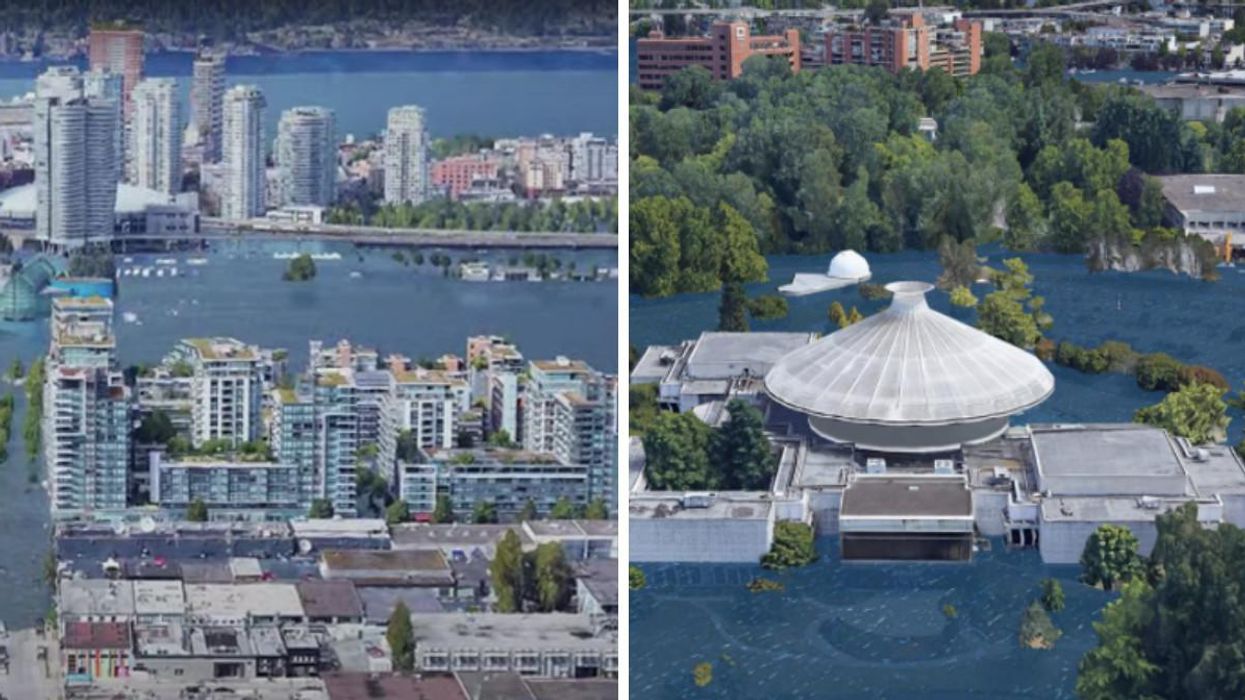
The image below shows a simulation of what BC Place in Vancouver would look like if climate change continues on the current path.

The image below shows the H.R. MacMillan Space Centre.

Overall the photos are pretty chilling, and make our potential future worrying.
- Climate Change Could Affect Sea Levels Across Canada & Some ... ›
- The Queen Just Roasted World Leaders Who 'Talk But They Don't Do' In A Rare Outburst - Narcity ›
- An 'Atmospheric River' Is Hitting Parts Of BC With So Much Rain There Might Be 'Flash Floods' - Narcity ›
- Greta Thunberg Shouts 'You Can Shove Your Climate Crisis Up Your Ass' At COP26 Protest (VIDEO) - Narcity ›
- A Woman In BC Is Canada's First Patient To Be Diagnosed As Suffering From 'Climate Change' - Narcity ›
- A BC Woman Was Diagnosed With Suffering From 'Climate Change' & It Could Be A World First - Narcity ›
- These Photos Show What Vancouver Transit Could Look Like In 2050 & It's Mind-Blowing - Narcity ›
- Vancouver Has Strict New Rules To Follow When Watering Your Lawn & You Could Get Fined $250 - Narcity ›
- This BC City Will Soon Face The Hottest Heat Waves In Canada & Here Are The 'Red Zones' - Narcity ›