A Nasty Storm Is Making Its Way To Toronto & Could Destroy Your Friday Night Plans
Cancel your patio plans.
If you were hoping to end the workweek by enjoying your first patio drinks of the season, you might want to reschedule thanks to a Toronto thunderstorm.
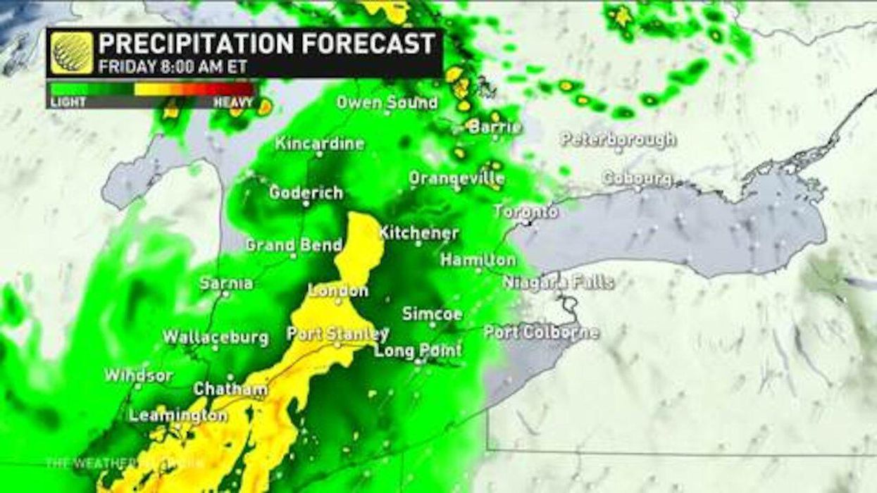
According to The Weather Network, a widespread storm threat looms over parts of southern Ontario this Friday with a possible onslaught of strong winds, heavy rain and large hail expected.
Cities that currently sit within the storm's "severe possible" zones include Windsor, London, Toronto, Barrie and Parry Sound.
"Though these nocturnal storms should be losing steam by the time they reach Ontario, they will have the potential to bring a shield of rain with embedded heavy downpours, gusty winds, and a few rumbles of thunder to southern Ontario early Friday," Michael Carter, a TWN meteorologist said.
"This would lead to the possibility of a round of severe storms developing across southern Ontario late in the afternoon and early evening, with the threat for large hail, damaging winds, and torrential downpours," he adds.
It's not all doom and gloom this weekend
Thankfully, the weekend will look much brighter. An abundance of sunshine is expected for the province on Saturday and Sunday across southern Ontario.
While a few rain showers could linger into Saturday morning, spots like Toronto will see temperatures soar into the high 20s by the afternoon.
By Sunday, it will be perfect patio weather, which temperatures in Toronto reaching 27 C. Yet, with humidity it could feel as warm as 32 C.
Monday and Tuesday of next week will see more rain and thunderstorms, so make sure to enjoy the sun while you can!