Ontario's Weather Is 'Blizzard-Like' In Some Spots RN & It's Making Travel Dangerous
Environment Canada has now issued winter storm warnings for seven regions.
Ontario's weather is turning frightful as bigger blasts of snow are expected to blow across the northwestern region of the province.
The Weather Network reports that serious snowfall and treacherous "blizzard-like" conditions are expected to hit parts of northwestern Ontario until the end of this week.
TWN is strongly advising to avoid travel when you can as "howling wind gusts" between 50 to 90 km/h are expected to hit some areas on Thursday and Friday, which could make driving down highways dangerous.
The is expected to start on Wednesday, November 10, which will increasingly get worse throughout the night.
The Weather Network is forecasting 20 to 40 centimetres of snow for areas between Fort Hope and Dryden, in the far northwestern and northwestern regions of Ontario.
Environment Canada has now issued winter storm warnings in seven regions in Ontario, where they're estimating local areas can get upwards of 50 centimeters of snow by Friday night. These warnings have been issued in the following areas: Dryden - Ignace, Kenora - Nestor Falls, Nipigon - Wabakimi, Pickle Lake - Wunnummin Lake, Red Lake - Ear Falls, Sandy Lake - Pikangikum, and Sioux Lookout - Savant Lake.
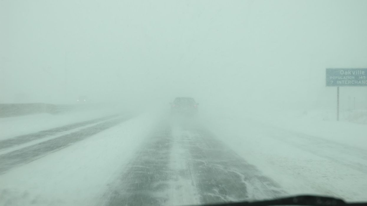
With this amount of snow, it may be more difficult to see where you're going on the roads. If you really have to go somewhere, EC is urging travelers to drive carefully, watch for tail lights up ahead, and be prepared to make a stop.
Public Safety Canada is also encouraging residents in these areas to come up with an emergency plan and have an emergency kit on hand and packed with food, water, a flashlight, a first-aid kit, and medicine.
As parts of northern Ontario turn into the North Pole, the southern regions of the province are so far being left unscathed. After all, Toronto's forecast is calling for a high of 12 C, partly sunny skies, and its first dusting of snow by next week.
This article's cover image was used for illustrative purposes only.
- Ontario's Weather Forecast Says A 'Snow Machine' Is Coming ... ›
- Ontario's Winter Weather Could Be Some Of The Worst In ... - Toronto ›
- Ontario's Weather Will Hit Some Spots With Up To 40 cm Of Snow ... ›
- Here's The Meaning Of 'Blizzard' & What To Look Out For In Ontario Today - Narcity ›
- Toronto Police Responded To 250 Weather-Related Calls Yesterday & Roads Are Still Awful - Narcity ›