Ontario's Snowstorm Could Be The Biggest In Years & Some Spots Are Getting Up To 50 cm
So many blizzard warnings have been issued, so you may want to stay home today! 🥶
Read the latest updates on Ontario weather here.
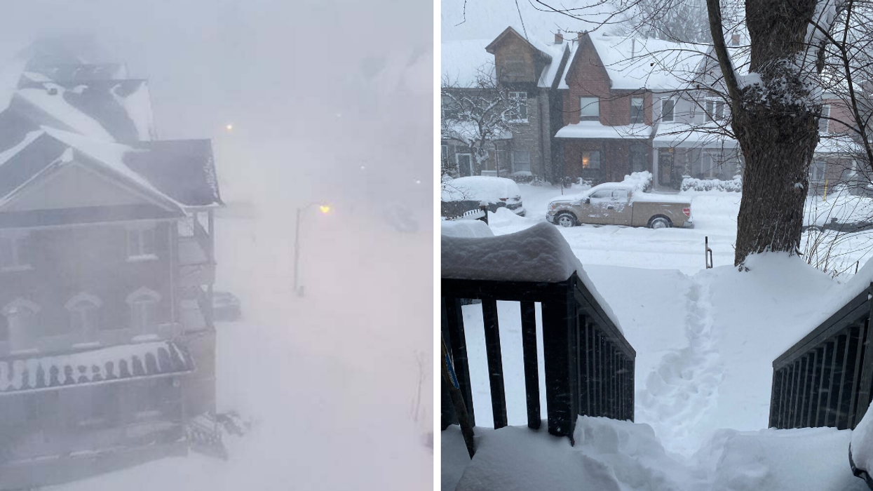
Ontarians who haven't taken a look outside their windows yet this morning may be in for a chilling surprise because the province is getting covered by blankets of snow.
"Widespread winter warnings span Ontario as one of the most impactful snowstorms in years threatens 30+ cm of snow through Monday," The Weather Network reports.
So, what parts of Ontario will get hit the hardest? Well, according to The Weather Network, Niagara, Hamilton, and southeastern Ontario could see 20 to 40+ centimetres of snow all throughout the day at a staggering rate of 2-4 (or even more!) centimetres per hour.
Global News’ chief meteorologist Anthony Farnell said it could be the “biggest winter storm we’ve had in several years,” in Ontario.
On top of getting blasted by snow, strong gusts of wind of 60 to 80 km/h are also blowing through the afternoon, so just cancel any hope of heading outdoors today.
Environment Canada has already issued seven blizzard warnings, 10 snowfall warnings, and 13 winter storm warnings all over southern Ontario.
The blizzard warnings are coming for Toronto, Hamilton, Niagara, Belleville, Halton - Peel, York - Durham and Dunnville.
"Hazardous blizzard conditions with heavy snow and strong winds are resulting in widespread near zero visibilities," an EC blizzard warning for the Niagara region reads.
A total of 30 to 50 centimetres is expected to hit with the worst conditions happening Monday morning until 11 a.m. — so Ontarians may want to prepare for some serious shovelling later.
With all of the buckets of snow getting dumped down, Environment Canada warns that travel could be hazardous due to the reduced visibility and driving could be seriously difficult.
This may have a huge impact on rush hour traffic, and according to EC, if you become stranded, don't leave your vehicle because it offers a layer against the blistering cold.
The forecast for the rest of the week, according to The Weather Network, will still be biting. Wintry temperatures will still cool the province with a few more centimetres of snow coming down on Tuesday and Wednesday — plus, "another shot of Arctic air for Thursday and Friday."
- Ontario's Weather Is About To Get Nasty With The Coldest ... ›
- Ontario's Weather Is Going To Be Wickedly Cold & Prepare For -45 ... ›
- Ontario's Weather Is Burying Some Spots In 20 cm Of ... - Toronto ›
- Here's How Much You Can Get Fined In Toronto If You Choose Not To Shovel Today - Narcity ›
- Toronto Police Responded To 250 Weather-Related Calls Yesterday & Roads Are Still Awful - Narcity ›
- An Ottawa Boy Found An Elderly Man Trapped In Yesterday's Snow & Helped Save His Life - Narcity ›
- Ontario's Weather Forecast Will Be Blasted With More Snow This Week & Can It Just Not - Narcity ›
- Every Single Person In Toronto Can Relate To This Really Tired Kid Shovelling Snow (VIDEO) - Narcity ›
- A Toronto Family Handed Out Coffee & Food To People Stranded On A Bus For Hours Yesterday - Narcity ›
- Toronto Man Walked In A Blizzard To A Resto & Fell To His Knees When It Was Closed (VIDEO) - Narcity ›
- A Toronto Man Walked 12 km To See His Girlfriend In A Blizzard & Filmed His Journey (VIDEO) - Narcity ›
- A Torontonian Who Walked In A Blizzard For Takeout Is Now On The Resto's Most Wanted List - Narcity ›
- A Nor'easter 'Bomb Cyclone' Threatens The East Coast With Weekend Snow & Powerful Winds - Narcity ›
- Extreme Cold Warning Issued For Toronto & Prepare For Some Freezing Temperatures - Narcity ›
- Toronto Could Beat Montreal In Snowfall Totals For First Time In Over 50 Years - Narcity ›